
Citizen Reporting Software for Cities (Potholes, Graffiti, Streetlights)
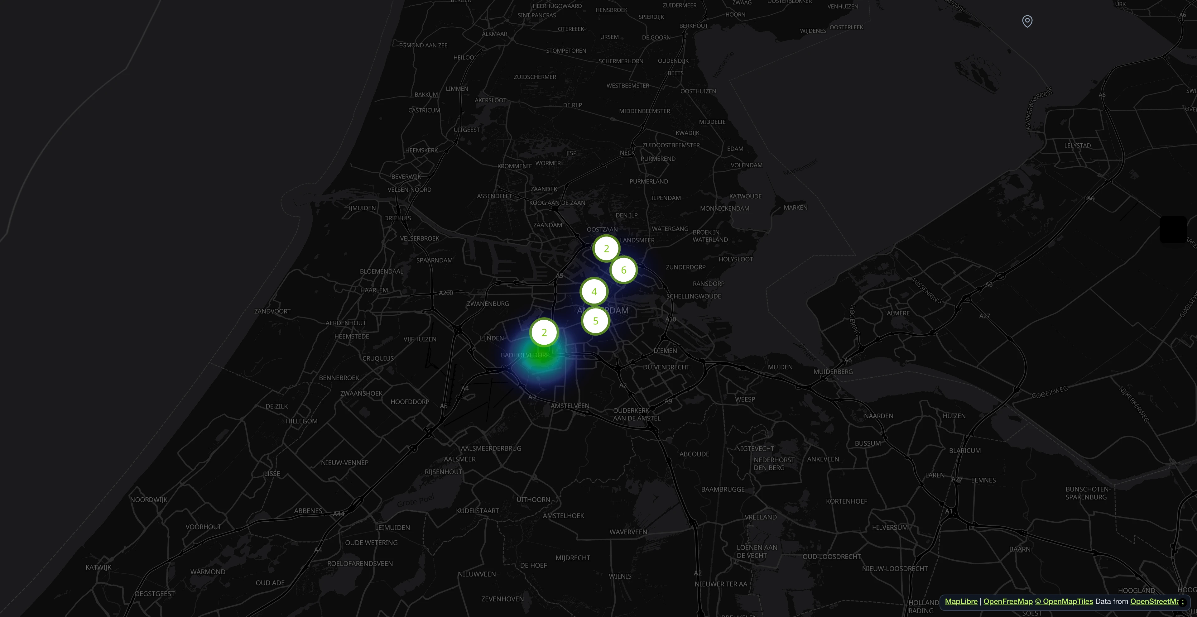
Collect civic issues like potholes, graffiti or broken streetlights on a map.
See it in action
From data collection to insights
A demo issue map of a municipality with sample reports: see what residents report and how the municipality answers in public.
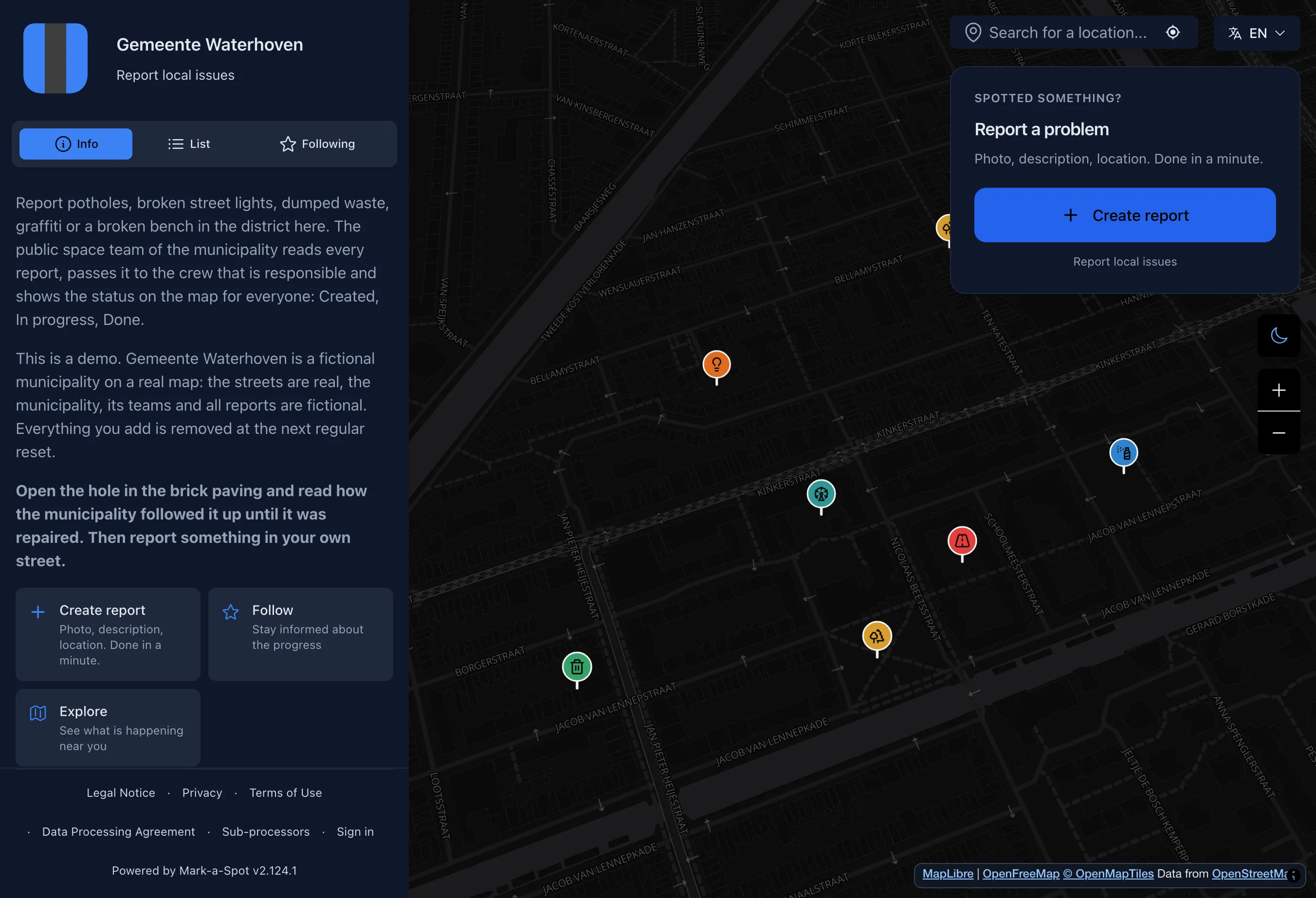
Every report in the municipality on one map
Residents report holes in the paving, dark street lights, dumped waste and broken benches. Everyone sees what has been reported and what the municipality is working on.
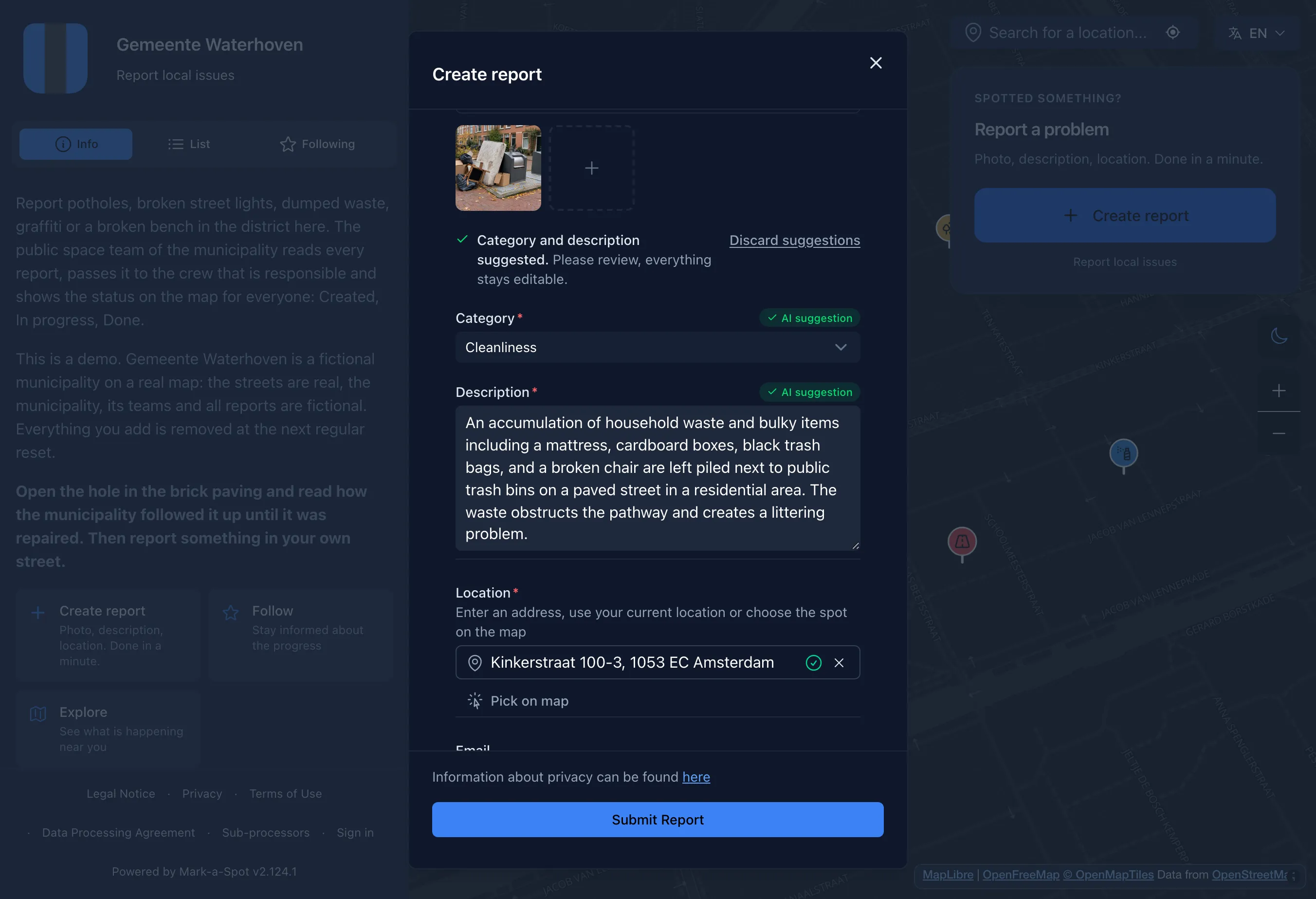
Take a photo, the AI suggests category and text
A resident photographs bulky waste dumped next to the bins. The AI suggests a category and a short description, and the resident checks everything and sends the report.
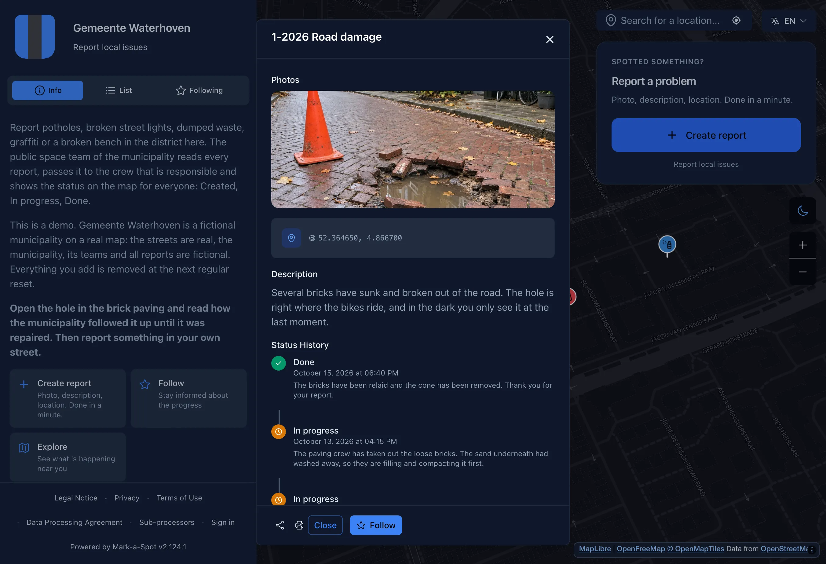
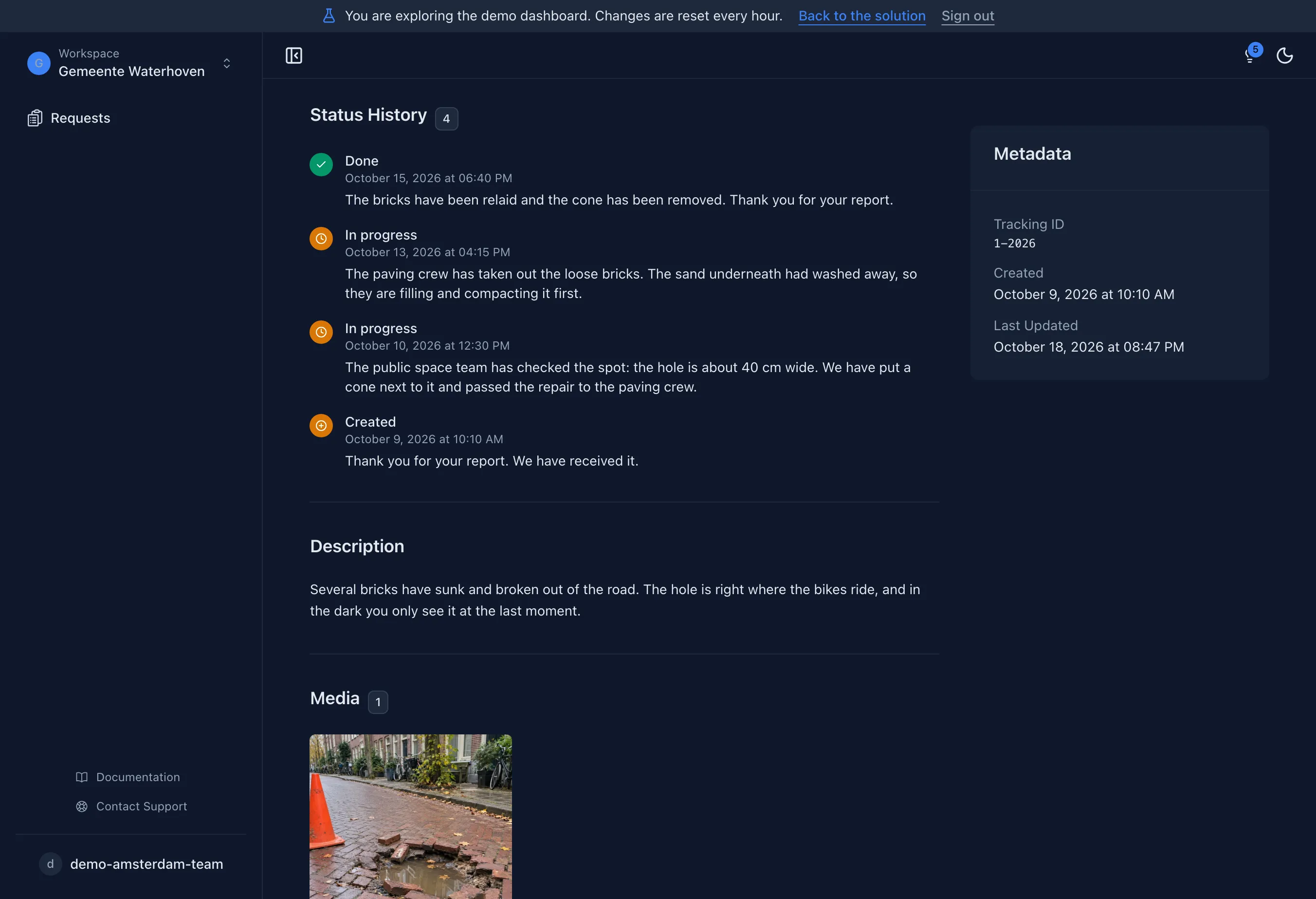
From a hole in the paving to relaid bricks
The public space team checks the spot, sets a cone and passes the report to the paving crew. The municipality answers in public, and the status is visible to everyone.
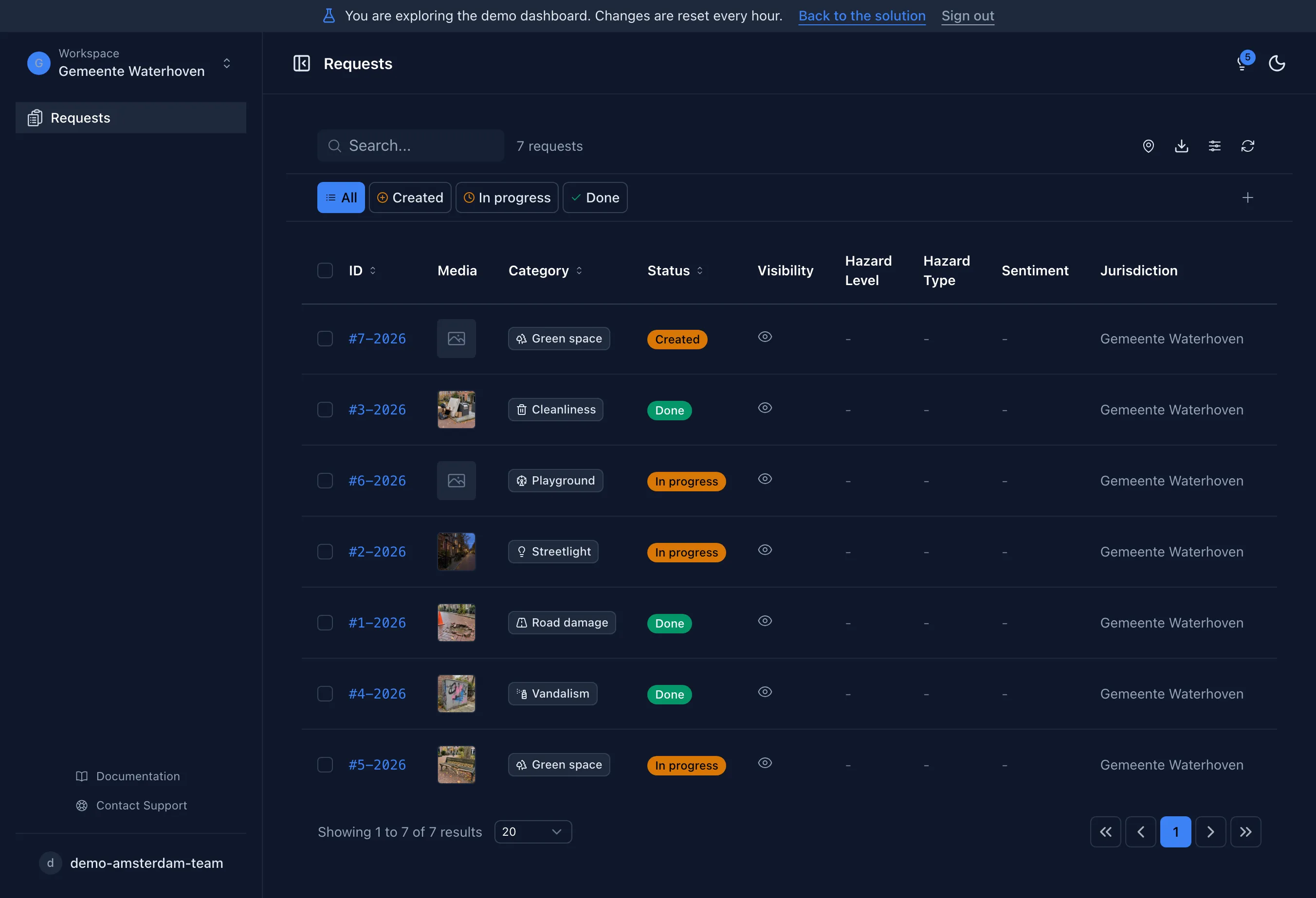
All reports in one inbox
The public space team filters by category and status and passes each report to the responsible crew.
No account needed.
See every step of a report
Open the report in the dashboard and look at its status, the public answers and the whole history, just as the public space team sees it.
No account needed.
- 1M+ reports since 2011
- Open Source
- Open311 GeoReport v2
- EU-hosted
What is a civic report platform?
Citizen issue reporting software lets residents flag infrastructure problems directly on a map. The most common urban issues, potholes, broken streetlights, illegal dumping, graffiti, damaged playground equipment, are submitted with a few taps, including a photo and GPS location. Cities like Munich, Bonn, and Duisburg already use this approach to manage thousands of reports per month.
Each submission goes straight to the management dashboard. City staff review each report there, assign it to a colleague (Pro plan), update the status, and can communicate with reporters. Residents see when their report moves from "received" to "in progress" to "resolved". The full lifecycle stays transparent and on record.
CivicSpot follows the Open311 GeoReport v2 standard, the same API used by cities from Chicago to Cologne. It connects to existing back-office systems without custom development. AI-powered photo analysis detects hazard levels and privacy issues (faces, license plates) automatically. All data is exportable via API, no vendor lock-in. Beyond municipalities, the platform is also used by housing companies, universities, and facility managers.
- Status Tracking
- Citizens see whether their report is pending, in progress, or resolved. Transparent from submission to fix.
- Status and Public Replies
- Staff update each report's status in the dashboard and reply publicly. Citizens follow the progress on the map.
- Open311 API
- Full Open311 compliance. Connects to existing back-office systems, SAP, and third-party integrations without custom development.
- AI Photo Analysis
- Uploaded photos are scanned automatically for hazard level and privacy (faces, license plates). Flags high-priority cases immediately.
Who is this for?
For municipalities
Manage pothole reports, streetlight outages, and graffiti complaints. Set statuses and reply publicly from one dashboard.
For public utilities
Track infrastructure damage reports across water, electricity, and waste management. Integrate via Open311 API.
For civic initiatives
Community groups collect neighbourhood issues and present them to the city council with data and photos.
Categories included
These categories come with the template. After setup you can rename, add or remove them in your dashboard.
- Road damage
- Streetlight
- Green space
- Cleanliness
- Playground
- Vandalism
Set up your Issue Reporter
Describe in one sentence what it is about. Then your map, categories and statuses are ready, and you can change everything.
More templates
Collect neighborhood ideas and suggestions on a shared map.
Collect ideas
Map accessibility barriers like missing ramps or broken elevators.
Map places
Monitor climate impacts like heat hotspots or flooding areas on a map.
Map places