
Piattaforma raccolta dati sul campo: ricerca e citizen science
Raccogli osservazioni georeferenziate per ricerca e studi sul campo.
Guarda in azione
Dalla raccolta dati agli approfondimenti
Le persone segnalano problemi, raccolgono idee e mappano luoghi importanti, sempre con foto e posizione.
Le immagini mostrano come esempio una mappa delle segnalazioni. Per i tuoi studi definisci tu categorie e caratteristiche.
Scatta una foto, l'IA propone categoria e testo
Chi segnala carica una foto. L'IA propone categoria, descrizione e caratteristiche. La persona controlla, corregge se serve e invia.

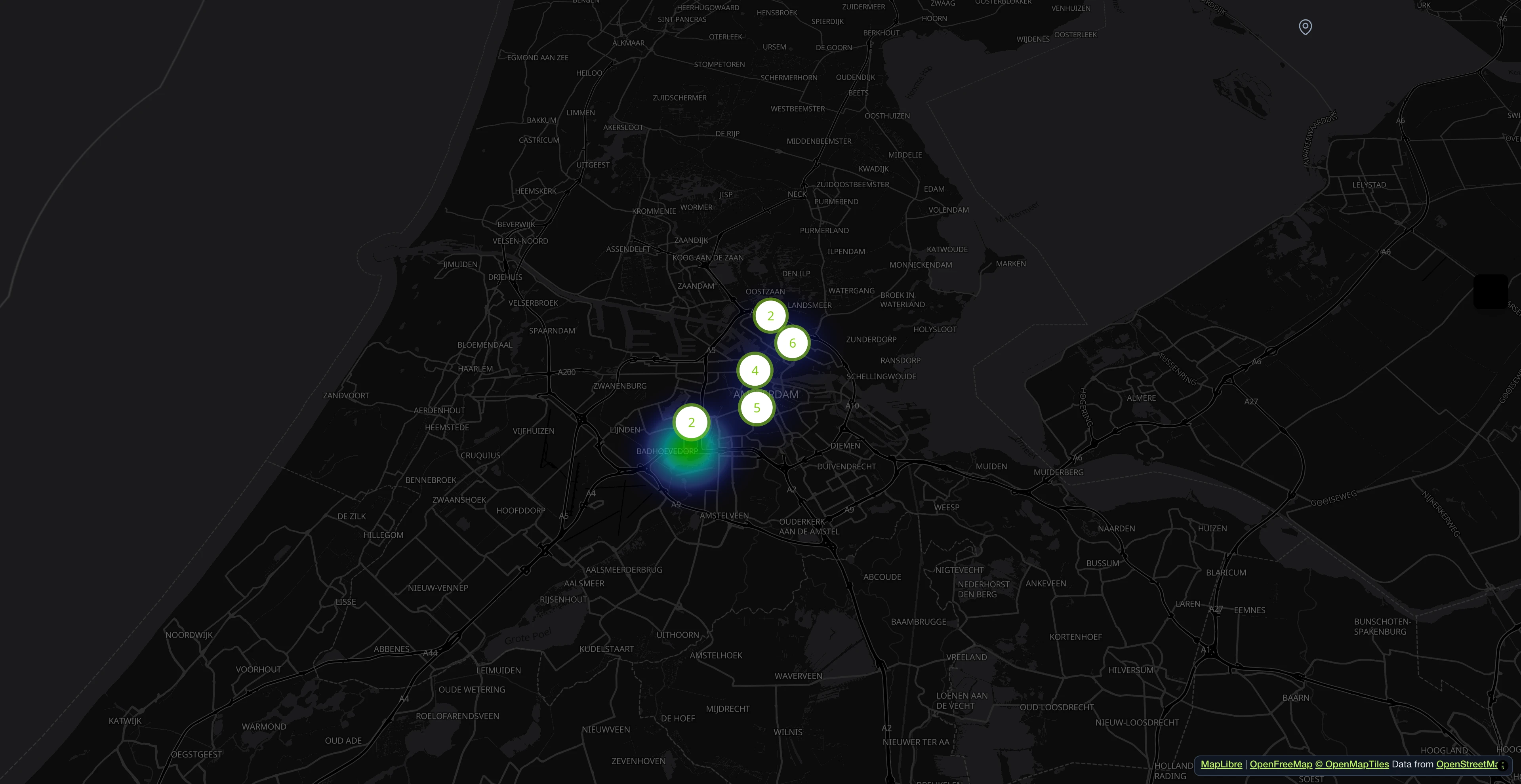
Segnalazioni su una mappa interattiva
Le persone segnalano problemi con foto e luogo. Sulla mappa si vede subito dove si concentrano le segnalazioni.

Tutte le segnalazioni a colpo d'occhio
Cerca, filtra e ordina tutte le segnalazioni in arrivo. Assegna reparti, aggiorna gli stati e tieni traccia di ogni problema dalla segnalazione alla risoluzione.

Ogni segnalazione con descrizione e caratteristiche
Dalla foto nascono proposte per descrizione, caratteristiche e livello di pericolo. Prima dell'invio si può cambiare tutto.

Pipeline di elaborazione con IA
Le segnalazioni doppie vengono riconosciute, i pericoli classificati e i campi precompilati. Tutto avviene in background.

Catalogo servizi conforme Open311
Ogni categoria viene fornita come servizio Open311 GeoReport v2 con attributi tipizzati, menu a discesa e label multilingua. Nessun vendor lock-in.

Tutto in un'unica dashboard
Indicatori, responsabilità e stati in un unico posto. L'IA segnala i pericoli nelle foto.

- Oltre 1 milione di segnalazioni dal 2011
- Open Source
- Open311 GeoReport v2
- Ospitato nell'UE
Provalo dal vivo:demo.mark-a-spot.com/amsterdam
Ti servono facility management, layer WMS personalizzati, campi dati strutturati per ogni stato del workflow o configurazioni multi-distretto e multi-città? Scopri la piattaforma completa sumark-a-spot.com
Che cos'è uno strumento di ricerca e raccolta dati sul campo?
Field data collection with Mark-a-Spot works on any smartphone or tablet. Research teams define their observation categories, each with custom attributes (species name, condition rating, sample type, or whatever the study requires). Contributors open the map, drop a pin at their location, take a photo, fill in the attributes, and submit. The record carries GPS coordinates from the device, a timestamp, and the photo with its EXIF metadata.
Professional researchers use FieldResearch for structured surveys: biodiversity monitoring across transects, archaeological site inventories, tree health assessments, environmental damage mapping after storms or floods. Citizen science projects use the same tool to mobilize volunteers at scale. A university publishes the map link, participants contribute observations from the field, and the dataset grows without hiring additional staff.
Every observation is accessible through the Open311 API, the same open standard used by cities worldwide. Filter by category, date range, or bounding box. Export to CSV for spreadsheets and GIS import via its coordinate columns, or consume the JSON API directly from R, Python, or any analysis pipeline. The dashboard provides visual summaries and direct download.
Data ownership stays with the project. The platform runs on open standards, so data is never locked in. Multi-language support covers 18 languages, making it suitable for international research collaborations. Photo documentation with GPS metadata provides verifiable evidence chains for regulatory compliance, academic publications, and long-term monitoring programs.
- Custom Attributes per Category
- Each observation category (Service Definition) carries its own attribute set: species name, condition rating, sample type, material, or any field your study needs. Configured in the admin panel, no code changes required.
- GPS Photo Documentation
- Every record includes a photo with GPS coordinates and EXIF metadata from the device. The combination of visual evidence and precise location creates a verifiable record chain for publications and regulatory compliance.
- Open311 API Export
- All data is accessible through the Open311 API. Filter by category, date, or bounding box. Use the JSON API from R, Python, or any analysis pipeline, or export CSV with coordinates for QGIS and ArcGIS.
- Multi-language Support
- The platform supports 18 languages, making it suitable for international research collaborations and cross-border citizen science projects. Categories and attributes can be localized.
A chi è destinato?
Progetti di ricerca universitaria
Costruisci dataset georeferenziati per studi sul campo con attributi personalizzati ed export strutturato.
Agenzie ambientali e monitoraggio
Documenta condizioni ambientali con registrazioni temporali e verificate con foto.
Documentazione archeologica
Registra reperti con coordinate GPS precise, foto e attributi configurabili.
Citizen science comunitaria
Coinvolgi volontari nella raccolta dati su larga scala. Condividi un link e i partecipanti contribuiscono da qualsiasi smartphone.
Categorie incluse
Queste categorie sono incluse nel modello. Dopo la configurazione puoi rinominarle, aggiungerne altre o rimuoverle dalla dashboard.
- Osservazione biodiversità
- Valutazione habitat
- Reperto archeologico
- Campione ambientale
- Ispezione infrastruttura
- Rilievo vegetazione
- Documentazione danni
Imposta Ricerca & Raccolta Dati sul Campo
Descrivi in una frase di cosa si tratta. Poi mappa, categorie e stati sono pronti e puoi modificare tutto.
Altri modelli
Documenta gli impatti climatici come isole di calore o zone alluvionali su una mappa.
Mappare luoghi
Monitora le condizioni dei sentieri: alberi caduti, erosione, ponti danneggiati.
Segnalare problemi
Documentare e seguire difetti di cantiere in opere civili, strutturali e impiantistiche prima della consegna.
Segnalare problemi